
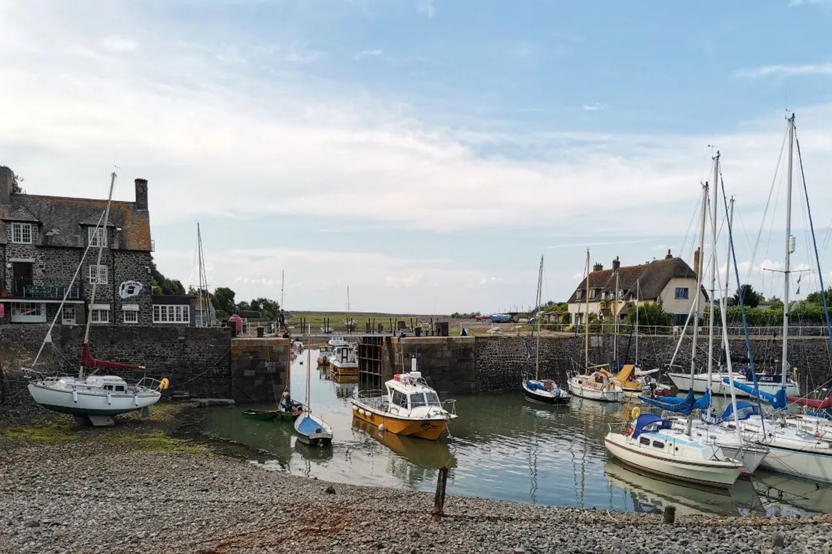
This is the second section of the South West Coast Path, counted from its start at Minehead. The South West Coast Path Association gives it as 12.1 miles (19.5 km) from Porlock Weir to Lynmouth and Lynton, and grades it challenging: moderate, with some more strenuous ascents. It does not publish a walking time for the section, so allow a full day and set your own pace.
The Association describes the route as dramatic cliff paths, farm tracks, fields and wooded combes with seasonal waterfalls and streams. Some of it is managed by the National Trust. What it doesn’t have is much in the way of shops. Porlock, Lynmouth and Lynton have plenty between them, but the Association notes there are few options on the route itself: you may find refreshments near Culbone, and there is an inn slightly inland at Countisbury. Carry food and water.
Culbone and the woods
The walk leaves the open harbour at Porlock Weir and climbs the steep slopes into Yearnor Wood. The first real stop is Culbone, and the Church of St Beuno. The Association says its main structure dates back to the 12th century, and that it is apparently the smallest complete parish church in England, at only 35ft long.
From Culbone there is a choice. You can take the clifftop route, with views over Exmoor and across to the Welsh coast, or the more direct path through the ancient Culbone Woods. The permitted path through the woods runs among old oaks and rare whitebeams. The Association notes the area was once used for charcoal burning, and that the remains of the burners’ huts can still be seen. It also suggests this stretch of coast was almost certainly the inspiration for the wild settings in Coleridge’s Kubla Khan and The Ancient Mariner, both written while he was staying on Exmoor.
Further on, look for the Sisters Fountain, a small holy well or spring beneath a 19th-century stone structure and cross. The names along here are worth the walk on their own: Pudleep Gurt, a wooded gully; Goat Rock; Twitchin Combe. At Coscombe the path crosses a stream that marks the county boundary. You leave Somerset and walk on into Devon.
Two stretches in this section, at Worthy and at Glenthorne, have recently been moved to new, more seaward lines as part of the works to establish the King Charles III England Coast Path. The Association says the new route is signed on site, so follow the waymarks rather than an older map or guidebook.
Countisbury, Foreland and the drop to Lynmouth
Towards Countisbury, look for Sir Robert’s Chair, a rocky outcrop below Windgate Combe that is popular with climbers. Foreland Point, which the National Trust describes as the northernmost tip of Devon, is close by, and the Trust warns of steep slopes around Countisbury and the Point.
The National Trust’s own route notes join the coast path on the grassy cliffs just beyond Countisbury church. They are candid about what comes next: at first it can seem as if you are walking off the edge, before the path bends left and runs along the cliffside towards Lynmouth. On a clear day, the Trust says, you can see across to Wales. The path skirts the remains of an Iron Age hill fort on Wind Hill, often called Countisbury Castle. The Trust describes it as one of the most impressive in Devon and thought to be the site of the Battle of Cynuit in AD 878.
Nearer Lynmouth, the path meets the A39 Lynmouth to Minehead road. The Trust asks walkers to take care with traffic here and to keep dogs on leads while the path runs along the top of the bank. From there it zigzags down to sea level and into Lynmouth. The Association picks out this last view of Lynmouth harbour and Lynton as one of the section’s highlights. Lynmouth is also one end of the Devon Coast to Coast walk, if you are tempted to keep going in a different direction.
Before you set out
This is a long day, and the Association’s safety advice applies in full. Stay back from cliff edges; some overhang or are unstable, and short grass is slippery when wet. Mobile reception is patchy on the coast, so tell someone your route and when you expect to finish. Mist, fog and high winds are more likely on the coast, so check the forecast and carry waterproofs. If you drop down to a beach, know the tide times so you are not cut off. Keep dogs under close control and give livestock a wide berth. Ordnance Survey’s Explorer OL9 covers Exmoor, including Minehead and Lynton.
Landslips and cliff falls can close parts of the path at short notice. The Association says storms and heavy rainfall in early 2026 caused erosion, cliff falls and landslips in parts of the South West. Check its route changes page before you go, and always follow the signs and diversions on the ground.
Getting back
This is a one-way walk. The Association notes there is little accommodation along the way to break it up. For a shorter day, walk out and return to Porlock Weir, or finish at the County Gate Visitor Centre, where there is a bus stop.
For the return from Lynmouth, the 300 bus (also known as the Exmoor Coaster or Explorer) connects Lynmouth with Minehead, and with Ilfracombe in the other direction. It is operated by Stagecoach. It is a summer service, so check the current timetable through Lynton & Lynmouth Town Council before you rely on it. Outside the season, or to be sure, book a local taxi in advance. Parking is at Porlock Weir, County Gate, Black Gate and Watersmeet.
Where to stay
- Harbour House Apartment, Porlock Weir. Its balcony overlooks the harbour.
- Chapel Knap, Porlock Weir. Sleeps 10.
- Beehive Cottage, Culbone. Its listing notes Culbone Woods and the South West Coast Path lie one field away, with private access.
- The School House, Countisbury. Sleeps 11, plus 2 on a sofa-bed.
- Lorna Doone Cottage, Lynmouth. Views over the East Lyn river.
Sources
- South West Coast Path Association, “Porlock Weir to Lynmouth / Lynton - Walk”, https://www.southwestcoastpath.org.uk/walksdb/137/ (and printable version https://www.southwestcoastpath.org.uk/walksdb/137/printable/) — distance 12.1 miles (19.5 km); challenging grading; section 2 from Minehead; route description (cliff paths, farm tracks, wooded combes, National Trust management, Yearnor Wood, clifftop or Culbone Woods choice, Welsh coast view, Coleridge); Culbone Church of St Beuno (12th century, “apparently the smallest complete parish church in England”, 35ft); oaks, whitebeams, charcoal burners’ huts; Sisters Fountain; Pudleep Gurt, Goat Rock, Twitchin Combe; Coscombe county boundary; Sir Robert’s Chair; Lynmouth harbour view and Devon Coast to Coast; route improvements at Worthy and Glenthorne; refreshments; shorter option and County Gate bus stop; parking.
- South West Coast Path Association, “Route changes”, https://www.southwestcoastpath.org.uk/walk-coast-path/south-west-coast-path-national-trail/route-changes/ and “Exmoor Route Improvement - Glenthorne”, https://www.southwestcoastpath.org.uk/walk-coast-path/south-west-coast-path-national-trail/route-changes/198/ — landslips and cliff falls closing sections; follow signs on the ground; early-2026 storms and rainfall; KCIII England Coast Path route improvements, signed on site.
- South West Coast Path Association, “Safety Advice”, https://www.southwestcoastpath.org.uk/about-coast-path/about-SWCP/safety-advice/ — cliff edges, slippery short grass, patchy mobile reception, mist/fog/wind, tide times on beaches, dogs and livestock.
- National Trust, “Lynmouth circular walk via Watersmeet and Countisbury”, https://www.nationaltrust.org.uk/visit/devon/watersmeet/lynmouth-circular-walk-watersmeet-countisbury — coast path from Countisbury church along the cliffs to Lynmouth; “as if you’re walking off the edge”; view to Wales; Wind Hill/Countisbury Castle hill fort and Battle of Cynuit AD 878; A39 crossing, dogs on leads, zigzag descent to sea level; Service 300 Minehead to Lynmouth.
- National Trust, “Cloud Farm Campsite to Foreland Point walk”, https://www.nationaltrust.org.uk/visit/devon/lorna-doone-valley/cloud-farm-campsite-to-foreland-point-walk — Foreland Point as the northernmost tip of Devon; steep slopes around Countisbury and Foreland Point.
- Lynton & Lynmouth Town Council, “Exmoor Buses Summer 2026”, https://lyntonandlynmouthtowncouncil.gov.uk/news/exmoor-buses-summer-2026/ — 300 bus (Exmoor Coaster / Explorer), operated by Stagecoach, services connecting at Lynmouth from Minehead and Ilfracombe; summer service.
- Ordnance Survey, “OS Map of Exmoor: Explorer OL9”, https://shop.osmaps.com/map-of-exmoor/ — OL9 covers Exmoor including Minehead and Lynton.